POSTPONED to 20th in view of (much) better forecast.
This will be our 122nd walk since The Group was formed.
We last walked this in August 2017 (see the video here).
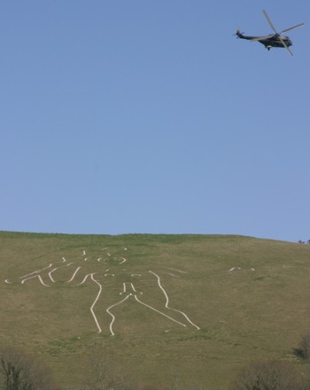
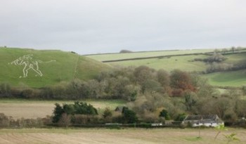
West Dorset is a lovely area for rambling and giving the hounds a good run. Quite unspoilt with lots of lovely valleys, woods and villages with Hardyesqe names like Piddletrenthide, Plush, Toller Porcorum and Ryme Intrinseca. Cerne Abbas is a gem of a village that time has slipped by. It lies 10 miles south of Yeovil reached by turning off the A37 to Dorchester road. Its main claim to fame is the Rude Giant recently seen on TV as it has been refurbished. Families with young children had better get ready to answer some pointed questions – or provide blindfolds.
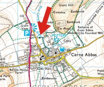
We'll meet at the car park opposite the village hall and just below the Giant's Viewpoint layby. Meet 10.30.
Instructions to find the start (opposite village hall). The nearest postcode is DT2 7GY (the village hall).
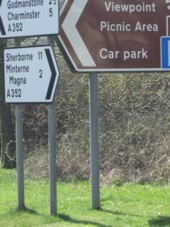
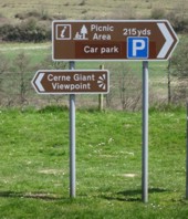
For those coming from the barren wastes of Wiltshire you'll probably come down the A352 via Sherborne. On nearing the village look for the sign shown on the right (top photo). Turn left and follow the next sign (the one below) to Village Hall and Parking. Turn left 50yds and the car park is just a short way on the left opposite the village hall.
Those coming from Devon will probably whizz along the A30 via Dorchester, in which case you'll arrive at the first sign from the south.
For those from beautiful Somerset, leave Yeovil, drive 11 miles down the fast A37 Dorchester road till after 1 mile after passing an odd tetrahedron water tower on the left on a hill, turn left to Cerne Abbas then three miles over a ford till you reach a cross roads at the edge of the village. Turn left for ¼ mile till you see the signpost (photo 1).
It'll be the usual five miles but hillier than some of the walks we have enjoyed, but remember the views are wonderful, and there's no gain without pain.
The route is the same as before: a little bit along the road to start - unavoidable I'm afraid - but then across fields and through Minterne Magna. All the (two) hills are in the morning, then it's level or downhill all the way back.
To finish we can recover our lost calories at possibly one of the better Cream Tea Places in the West Country (garden at back that welcomes Hounds: mine know the way there by scent from Somerset).
Map ref is ST663014 (Explorer map 117 Cerne Abbas and Bere Regis).
|